ZIP code 53208 is in Milwaukee County, Wisconsin. About 27,201 people live here in 11,696 households. The median home value is $204,500 and the median household income $52,690. The average commute takes about 23 minutes.
ZIP code tabulation area · ACS 2020–2024 · Updated October 24, 2026
86%of households have broadbandhome internet subscription
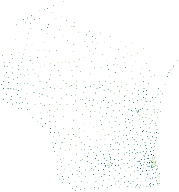
53208 in WisconsinZIP codes coloured by median household income
53208
<$45K$125K+
Sources: U.S. Census Bureau, American Community Survey 2020–2024 5-year estimates · U.S. Census Bureau, 2024 Gazetteer and 2020 ZCTA relationship files
People.
27,201 residents in 11,696 households, next to the Milwaukee County figure.
26%
under 18
HereMilwaukee County
27%
aged 18–34
HereMilwaukee County
12%
aged 65 and over
HereMilwaukee County
43%
of households are people living alone
HereMilwaukee County
23%
of households are married couples
HereMilwaukee County
Source: U.S. Census Bureau, American Community Survey 2020–2024 5-year estimates
Homes.
13,806 housing units; the median owner-occupied home is valued at $204,500 (±$11,429).
39%
of households own their home
HereMilwaukee County
32%
of homes are detached single-family houses
HereMilwaukee County
28%
are in buildings with 5 or more units
HereMilwaukee County
0%
are mobile homes
HereMilwaukee County
15%
of housing units are vacant
HereMilwaukee County
$936
median gross rent a month
HereMilwaukee County
When homes were built
2020 or later0%
2010–20193%
2000–20093%
1990–19990%
1980–19892%
1970–19794%
1960–19697%
1950–19598%
1940–194911%
1939 or earlier62%
Source: U.S. Census Bureau, American Community Survey 2020–2024 5-year estimates
Income and work.
Household income and work, in 2024 dollars; median household income ±$5,376.
$52,690
median household income
HereMilwaukee County
21.6%
of people live below the poverty line
HereMilwaukee County
5.9%
unemployment rate
HereMilwaukee County
33%
of adults 25+ hold a bachelor’s degree or higher
HereMilwaukee County
The poverty rate uses the federal poverty thresholds, which vary with family size. It says nothing on its own about what a neighborhood is like to live in.
Source: U.S. Census Bureau, American Community Survey 2020–2024 5-year estimates
Getting around.
How workers aged 16 and over get to work, and how long it takes.
23 min
average commute to work
HereMilwaukee County
6%
of commuters travel 45 minutes or more
HereMilwaukee County
74%
of workers drive or carpool
HereMilwaukee County
8%
take public transportation
HereMilwaukee County
4%
walk or bike
HereMilwaukee County
14%
work from home
HereMilwaukee County
23%
of households have no car
HereMilwaukee County
Source: U.S. Census Bureau, American Community Survey 2020–2024 5-year estimates
Internet.
Home internet subscriptions.
86%
of households have a broadband subscription
HereMilwaukee County
11%
have no internet access at home
HereMilwaukee County
American Community Survey figures are estimates from a rolling sample, averaged over 2020–2024. Each comes with a margin of error, which is wider in places with fewer people.
Source: U.S. Census Bureau, American Community Survey 2020–2024 5-year estimates
Businesses in 53208.
527 business establishments with paid employees have an address in this ZIP code.
Grocery stores and supermarkets10
Convenience stores4
Pharmacies and drug stores6
Retail bakeries0
Full-service restaurants16
Limited-service restaurants10
Coffee shops and snack bars4
Bars8
Physicians’ offices9
Dentists’ offices0
Child care centers37
Gyms and fitness centers0
Movie theaters0
Museums0
Counts are business establishments with paid employees, by the ZIP code of their address. Self-employed people without staff, and public facilities such as libraries, are not included.
Source: U.S. Census Bureau, ZIP Code Business Patterns 2023
Health.
Estimated share of adults in 53208, next to the national figure.
79%
had a routine checkup in the past year
HereUnited States
54%
visited a dentist in the past year
HereUnited States
12%
of 18–64s have no health insurance
HereUnited States
33%
get no leisure-time physical activity
HereUnited States
42%
usually sleep less than 7 hours
HereUnited States
19%
smoke
HereUnited States
43%
have obesity
HereUnited States
16%
have diagnosed diabetes
HereUnited States
38%
have high blood pressure
HereUnited States
28%
report fair or poor general health
HereUnited States
19%
report frequent mental distress
HereUnited States
38%
often feel lonely
HereUnited States
31%
faced food insecurity in the past year
HereUnited States
23%
faced housing insecurity in the past year
HereUnited States
16%
lacked reliable transportation in the past year
HereUnited States
These are model-based estimates for adults from the CDC’s PLACES project, combining national health surveys with local population data. They are not counts of local patients, and small differences between nearby ZIP codes are within the margin of the model.
Source: Centers for Disease Control and Prevention, PLACES 2025 release (ZCTA), public domain
Nearest public schools.
In a straight line from the center of the ZIP code. Attendance zones are set by each school district.
Story ElementaryMilwaukee0.4 mi
Bethune AcademyMilwaukee0.7 mi
Woodlands School - State Street CampusMilwaukee0.7 mi
Hawley Environmental SchoolMilwaukee0.8 mi
Pathways HighMilwaukee0.9 mi
Source: National Center for Education Statistics, EDGE public school locations 2024–25
Nearby ZIP codes.
ZIP codes here are the Census Bureau’s ZIP Code Tabulation Areas, which closely match the postal ZIP codes used for addresses.
 53208