Ullern
The Ullern district of Oslo had 35,805 residents on 1 January 2026. Median household income after tax was NOK 832,800 in 2024, 31% above the municipal level. 22% of households rented their home, and 5% lived in overcrowded conditions. The population has grown by 9.3% since 2016.
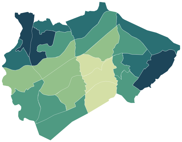
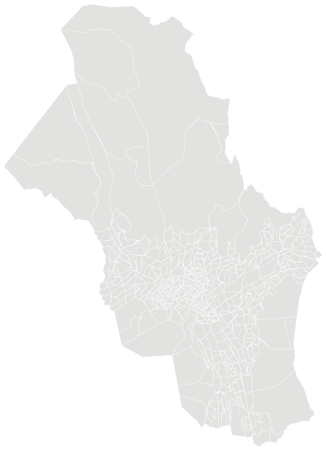

Sources: Statistics Norway (SSB), StatBank (CC BY 4.0) · © Norwegian Mapping Authority, basic statistical units (CC BY 4.0) · © OpenStreetMap contributors (ODbL)
All 24 neighbourhoods.
Colour shows where each one sits among the others in the table, from lowest to highest.
| Neighbourhood | Residents | 67+ | Under 16 | Per km² | Green 500 m | Services 15 min |
|---|---|---|---|---|---|---|
| Abbedikollen | 1,037 | 20% | 19% | 3,988 | 10% | 135 |
| Amalienborg | 1,307 | 25% | 15% | 8,169 | 17% | 147 |
| Bestum | 1,661 | 14% | 22% | 4,614 | 16% | 110 |
| Bjørnsletta | 2,098 | 26% | 16% | 5,379 | 13% | 138 |
| Furulund | 1,877 | 18% | 19% | 3,413 | 11% | 135 |
| Hoff nord | 2,548 | 17% | 14% | 6,886 | 7% | 143 |
| Hoff sør | 527 | 13% | 17% | 1,647 | 10% | 132 |
| Husebybakken | 1,531 | 25% | 14% | 3,328 | 22% | 99 |
| Lysaker | 2,139 | 17% | 17% | 4,278 | 16% | 137 |
| Lysehagan | 974 | 14% | 20% | 3,044 | 24% | 132 |
| Madserud | 995 | 20% | 14% | 1,809 | 62% | 346 |
| Montebello | 1,063 | 13% | 15% | 2,044 | 19% | 67 |
| Nordre Skøyen | 1,523 | 16% | 18% | 4,116 | 15% | 136 |
| Rolighet | 1,712 | 15% | 23% | 5,188 | 35% | 112 |
| Sjølyst | 1,770 | 20% | 9% | 5,206 | 16% | 153 |
| Smestad | 1,334 | 23% | 17% | 2,187 | 25% | 347 |
| Smestaddammen | 1,690 | 21% | 17% | 4,447 | 14% | 129 |
| Sollerud | 2,006 | 16% | 22% | 5,144 | 10% | 107 |
| Søndre Skøyen | 1,717 | 12% | 24% | 5,539 | 27% | 187 |
| Ullerntoppen | 1,178 | 30% | 14% | 5,355 | 29% | 126 |
| Ullernåsen | 1,271 | 17% | 21% | 3,435 | 34% | 115 |
| Vækerø | 118 | 4% | 21% | 358 | 16% | 89 |
| Åsjordet | 1,749 | 32% | 11% | 4,997 | 20% | 115 |
| Øraker | 1,977 | 13% | 21% | 4,206 | 15% | 137 |
Sources: Statistics Norway (SSB), StatBank (CC BY 4.0) · © OpenStreetMap contributors (ODbL)
People.
Age on 1 January 2026, next to the figure for Oslo.
Population on 1 January
In official statistics, districts (bydeler) exist only for Oslo, Bergen, Trondheim and Stavanger. Population, income, education and housing figures are Statistics Norway’s own district figures; services, green space and land area are worked out from the basic units that make up the district.
Source: Statistics Norway (SSB), StatBank (CC BY 4.0)
The whole municipality.
Figures for Oslo as a whole.
Source: Statistics Norway (SSB), StatBank (CC BY 4.0)
Income and work.
Income in 2024 and education in 2025.
Education, aged 16 and over
Income after tax is a household’s total income minus tax and negative transfers, for private households in 2024. The median is the middle value, so a few high incomes do not pull it up.
Source: Statistics Norway (SSB), StatBank (CC BY 4.0)
Homes.
16,899 private households in 2026, with 2.1 people per household on average.
Households by tenure, 2025
Households by type of building, 2025
Statistics Norway counts a household as overcrowded when the home has both few rooms and little floor space for the number of people living there. Shares are for households in 2025.
Source: Statistics Norway (SSB), StatBank (CC BY 4.0)
Everyday life.
144 everyday shops and services within a 15-minute walk; 19% green space within 500 metres.
Services and green space are measured from each area’s service centre: the point inside it with the most shops and services within 500 metres. District, municipal and county figures are averages weighted by population.
Source: © OpenStreetMap contributors (ODbL)
Other districts of Oslo.