Randers
Randers had 100,564 residents on 1 January 2026. Average disposable income was DKK 256,955 per person in 2024, 7% below the regional average. 49% of occupied homes were lived in by their owner, and 17% were social housing (almene boliger). The population has grown by 3.1% since 2016.
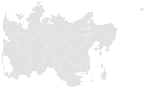
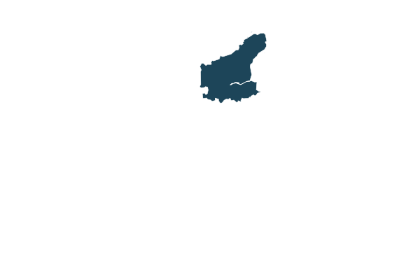
Sources: Own calculations based on figures from Statistics Denmark (StatBank) · © OpenStreetMap contributors (ODbL); municipal and regional boundaries from OpenStreetMap
All 54 parishes.
Colour shows where each one sits among the others in the table, from lowest to highest.
| Parish | Residents | 65+ | Under 18 | Avg. age | In work | Master’s level | Green 500 m | Services 15 min |
|---|---|---|---|---|---|---|---|---|
| Albæk | 407 | 23% | 17% | 46.1 | 67% | 5% | 15% | 6 |
| Asferg | 955 | 23% | 19% | 45.3 | 64% | 3% | 0% | 8 |
| Borup | 428 | 22% | 20% | 43.6 | 65% | 5% | 3% | 4 |
| Dalbyneder | 93 | 18% | 18% | 45.5 | 56% | 9% | 7% | 0 |
| Dalbyover | 288 | 22% | 16% | 45.3 | 56% | 4% | 1% | 1 |
| Dronningborg | 4,509 | 27% | 18% | 46.5 | 55% | 6% | 20% | 48 |
| Enghøj | 7,535 | 22% | 22% | 43.1 | 61% | 5% | 25% | 39 |
| Enslev | 285 | 19% | 19% | 43.4 | 68% | 3% | 4% | 1 |
| Essenbæk | 4,165 | 21% | 25% | 42.2 | 65% | 7% | 11% | 31 |
| Fårup | 1,131 | 24% | 20% | 44.4 | 62% | 4% | 2% | 15 |
| Gassum | 845 | 17% | 20% | 43.2 | 68% | 2% | 2% | 2 |
| Gimming | 1,496 | 12% | 30% | 37.2 | 77% | 9% | 8% | 0 |
| Gjerlev | 923 | 26% | 20% | 45.4 | 53% | 2% | 3% | 7 |
| Grensten | 2,853 | 17% | 29% | 38.7 | 71% | 9% | 4% | 0 |
| Hald | 572 | 19% | 19% | 43.3 | 64% | 2% | 1% | 3 |
| Harridslev | 1,624 | 22% | 24% | 41.8 | 64% | 4% | 3% | 19 |
| Haslund | 1,429 | 21% | 18% | 44.1 | 69% | 5% | 3% | 28 |
| Helstrup | 257 | 23% | 17% | 44.5 | 68% | 5% | 8% | 0 |
| Hornbæk | 4,016 | 23% | 24% | 43.0 | 66% | 13% | 35% | 52 |
| Hørning | 535 | 15% | 24% | 39.2 | 71% | 7% | 2% | 2 |
| Kastbjerg | 200 | 21% | 18% | 44.2 | 64% | 4% | 16% | 0 |
| Kousted | 199 | 23% | 21% | 42.7 | 66% | 5% | 1% | 0 |
| Kristrup | 9,929 | 21% | 22% | 42.6 | 63% | 6% | 6% | 79 |
| Kærby | 139 | 19% | 17% | 42.2 | 72% | 3% | 2% | 2 |
| Langå | 3,046 | 25% | 20% | 45.1 | 57% | 10% | 6% | 22 |
| Lem | 282 | 22% | 15% | 46.1 | 66% | 2% | 0% | 0 |
| Linde | 870 | 19% | 21% | 42.8 | 66% | 4% | 0% | 0 |
| Læsten | 179 | 20% | 16% | 44.7 | 73% | 6% | 15% | 1 |
| Mellerup | 536 | 26% | 21% | 45.8 | 60% | 5% | 6% | 9 |
| Nørbæk | 219 | 12% | 20% | 39.8 | 67% | 6% | 3% | 0 |
| Råby | 431 | 25% | 15% | 45.2 | 56% | 4% | 5% | 1 |
| Råsted | 545 | 24% | 18% | 44.3 | 59% | 3% | 6% | 1 |
| Sankt Andreas | 5,507 | 20% | 22% | 41.2 | 46% | 3% | 10% | 98 |
| Sankt Clemens | 9,246 | 23% | 17% | 44.0 | 54% | 6% | 15% | 122 |
| Sankt Mortens | 8,651 | 23% | 10% | 44.6 | 50% | 6% | 8% | 180 |
| Sankt Peders | 7,878 | 18% | 13% | 41.7 | 55% | 5% | 10% | 179 |
| Spentrup | 2,643 | 22% | 22% | 43.1 | 65% | 3% | 13% | 28 |
| Støvring | 242 | 27% | 15% | 48.4 | 71% | 5% | 4% | 0 |
| Sødring | 313 | 33% | 11% | 50.2 | 53% | 2% | 40% | 2 |
| Sønderbæk | 286 | 16% | 18% | 44.1 | 68% | 3% | 23% | 2 |
| Torup | 168 | 21% | 19% | 44.6 | 73% | 10% | 11% | 0 |
| Tvede | 228 | 21% | 12% | 46.9 | 63% | 3% | 35% | 1 |
| Tånum | 408 | 20% | 20% | 43.6 | 63% | 10% | 3% | 0 |
| Udbyneder | 1,245 | 22% | 18% | 44.6 | 57% | 3% | 1% | 2 |
| Virring | 957 | 22% | 19% | 44.9 | 66% | 5% | 30% | 1 |
| Vorup | 7,126 | 24% | 19% | 44.0 | 61% | 6% | – | – |
| Værum | 390 | 23% | 20% | 44.2 | 64% | 2% | 16% | 8 |
| Ålum | 573 | 25% | 16% | 46.8 | 69% | 8% | 17% | 2 |
| Årslev | 169 | 23% | 19% | 45.0 | 64% | 4% | 2% | 0 |
| Ølst | 397 | 18% | 21% | 42.3 | 69% | 7% | 17% | 0 |
| Ørum | 469 | 22% | 21% | 43.5 | 68% | 8% | 4% | 0 |
| Øster Bjerregrav | 1,304 | 25% | 20% | 44.8 | 63% | 5% | 1% | 18 |
| Øster Tørslev | 1,139 | 25% | 20% | 45.2 | 60% | 3% | 9% | 13 |
| Øster Velling | 290 | 18% | 24% | 42.1 | 61% | 7% | 2% | 0 |
Sources: Own calculations based on figures from Statistics Denmark (StatBank) · © OpenStreetMap contributors (ODbL); municipal and regional boundaries from OpenStreetMap
People.
Age on 1 January 2026, next to the figure for Central Denmark Region.
Population on 1 January
Source: Own calculations based on figures from Statistics Denmark (StatBank)
Work, income and education.
Work on 1 January 2025 and highest completed education on 1 October 2025, residents aged 15 and over.
Highest completed education
Disposable income is what is left for spending and saving once tax and interest have been paid. The figure is an average for everyone in the area in 2024.
Parish unemployment comes from residents’ socio-economic status on 1 January 2025. The municipal rate is full-time unemployment averaged over 2025. The two are measured differently.
Source: Own calculations based on figures from Statistics Denmark (StatBank)
Homes.
49,688 occupied homes in 2026.
Types of home
Year built
Source: Own calculations based on figures from Statistics Denmark (StatBank)
Everyday life.
70 everyday shops and services within a 15-minute walk; 12% green space within 500 metres.
Shops and services are counted within 1.2 km in a straight line from the parish church, green space within 500 metres. Municipal and regional figures are averages weighted by population.
Source: © OpenStreetMap contributors (ODbL); municipal and regional boundaries from OpenStreetMap
Around here.
Photographs taken near Randers, shared on Wikimedia Commons under free licences.

i


i


i

Other municipalities in Central Denmark Region.