NL · EN

Banne Buiksloot

Banne Buiksloot is one of 110 districts in Amsterdam, with 14,725 residents and 6,289 homes in 6 neighbourhoods. The average WOZ value of €409,000 is 21% below the municipal average. On average 35% of the land within 500 metres of a home is green space.
District 0363NE · 6 neighbourhoods · 287 postcodes · Updated 24 October 2026
14,725residents1 January 2025
€409,000average WOZ home valueAmsterdam: €518,000
35%green within 500 mAmsterdam: 23%
167services within 15 minutesmedian postcode
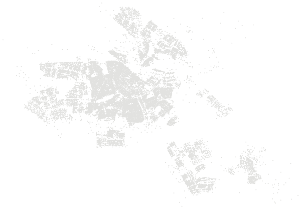
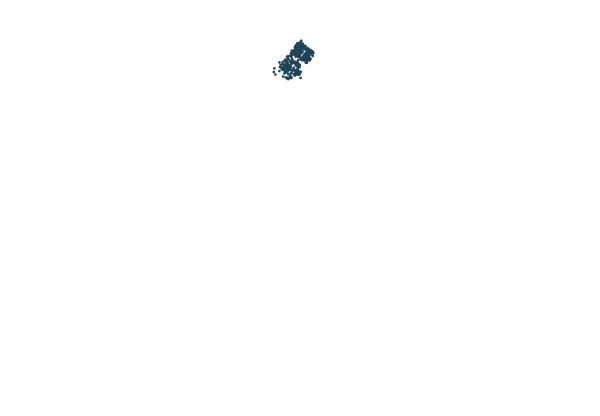
Banne Buiksloot in AmsterdamPostcodes in Banne Buiksloot highlighted; the rest of Amsterdam in grey
Map of Amsterdam with Banne Buiksloot highlighted

Neighbourhoods of Banne Buiksloot.

Colour shows where each neighbourhood sits among all 488 neighbourhoods in Amsterdam.

NeighbourhoodResidentsWOZ valueOwner-occupiedSingle-familyAged 65+Green 500 mServices 15 min
Banne-Noordwest2,590€337k21%7%13%37%142
Banne-Noordoost3,545€384k32%16%16%35%143
Banne-Zuidwest3,690€406k26%17%19%35%192
Banne-Zuidoost4,245€439k34%22%18%34%196
Buiksloterbreek305€781k97%90%25%28%184
Marjoleinterrein340€518k51%43%6%31%205

Sources: Statistics Netherlands (CBS), Key figures for districts and neighbourhoods 2025 (CC BY 4.0) · © OpenStreetMap contributors (ODbL)

Homes.

The average WOZ value of a home in Banne Buiksloot is €409,000, against €518,000 in Amsterdam.

6,289homes1 January 2025
18%single-family houses82% flats and apartments
31%owner-occupied61% housing association
7%built in the last ten years3% unoccupied
570 m³gas per home per yearAmsterdam: 580 m³
2,000 kWhelectricity per home per yearAmsterdam: 1,880 kWh
25%homes off the gas gridAmsterdam: 19%
16%homes with solar panelsAmsterdam: 10%

The WOZ value is the official valuation each Dutch municipality sets every year for property tax. It is not a sale price. The averages here use the valuation date of 1 January 2024.

Source: Statistics Netherlands (CBS), Key figures for districts and neighbourhoods 2025 (CC BY 4.0)

Income and work.

How households in Banne Buiksloot compare with the national income distribution (reporting year 2024).

52%of households in the lowest 40% nationallyAmsterdam: 50%
14%in the top 20% nationallyAmsterdam: 18%
6.8%of residents live below the poverty lineAmsterdam: 6.7%
€10,000median household wealthAmsterdam: €15,000
65.0%of 15 to 75-year-olds in workAmsterdam: 71.0%
28%with a university or higher professional degreeAmsterdam: 50%
19.0%of workers are self-employedAmsterdam: 21.0%
0.6cars per householdAmsterdam: 0.4

Statistics Netherlands ranks every household in the country by income. In a neighbourhood that matched the national mix exactly, 40% of households would fall in the lowest 40% nationally and 20% in the top 20%. Income on its own says nothing about what a place is like to live in.

Source: Statistics Netherlands (CBS), Key figures for districts and neighbourhoods 2024: income, work and education (CC BY 4.0)

Safety.

Police registered 749 crimes in Banne Buiksloot in 2025, 5% more than in 2024. That is 50.9 per 1,000 residents, compared with 85.6 across Amsterdam.

Theft from vehicles83
Theft of bicycles and mopeds77
Vandalism and criminal damage64
Other property crime53
Assault39
Threats38
Vehicle theft22
Burglary of homes14
Driving under the influence8
Street robbery6
Pickpocketing3
Public violence against people2
Hold-up robbery1

Registered crime shows what becomes known to the police, not how safe a place feels, and not every crime is reported. Town centres, shopping areas and the streets around stations have few residents but many visitors, which pushes the rate per 1,000 residents up. The categories above are a selection; the total includes every registered crime.

Source: Dutch Police, registered crime by district and neighbourhood, 2024–2025 (CC BY 4.0)

Everyday distances.

Average distance by road for everyone living in Banne Buiksloot, a very highly urban area.

Distance to

GP practice0.8 km
Large supermarket0.8 km
Day nursery0.4 km
Primary school0.7 km

Also

Primary schools within 3 km14.5
Primary pupils living here1,380
Secondary pupils living here950
Business premises1,910
Residents per km²8,889
Land area166 ha

Source: Statistics Netherlands (CBS), Key figures for districts and neighbourhoods 2025 (CC BY 4.0)

More in Amsterdam.

Every district in Amsterdam.

HaarlemmerbuurtJordaanGrachtengordel-WestBurgwallen-Nieuwe ZijdeBurgwallen-Oude ZijdeNieuwmarkt/LastageGrachtengordel-ZuidDe WeteringschansWeesperbuurt/PlantageOostelijke Eilanden/KadijkenHavens-WestCoenhaven/MinervahavenSloterdijk-WestSpaarndammerbuurt/ZeeheldenbuurtHouthavensDe KolenkitLandlustErasmusparkCentrale MarktStaatsliedenbuurtFrederik HendrikbuurtVan GalenbuurtGeuzenbuurtHoofdweg e.o.ChassébuurtBellamybuurtDa CostabuurtWestindische BuurtVan LennepbuurtOvertoomse SluisHelmersbuurtVondelparkbuurtSloterdijk Nieuw-WestGeuzenveldSlotermeer-WestSlotermeer-NoordoostSlotermeer-ZuidoostLutkemeer/OokmeerDe AkerDe PuntOsdorp-MiddenOsdorp-OostSlotervaart-NoordOvertoomse VeldSlotervaart-ZuidWestlandgrachtSloten/Nieuw-SlotenHoofddorppleinbuurtSchinkelbuurtWillemsparkMuseumkwartierOude PijpNieuwe PijpZuid PijpStadionbuurtApollobuurtScheldebuurtIJselbuurtRijnbuurtPrinses Irenebuurt e.o.ZuidasBuitenveldert-WestBuitenveldert-OostOostelijk HavengebiedWeesperzijdeOosterparkbuurtTransvaalbuurtDapperbuurtIndische Buurt-WestIndische Buurt-OostZeeburgereiland/BovendiepIJburg-WestIJburg-OostIJburg-ZuidFrankendaelMiddenmeerBetondorpOmval/OveramstelOostzanerwerfNoordelijke IJ-oevers-WestTuindorp OostzaanKadoelenNieuwendammerdijk/BuiksloterdijkElzenhagenBuikslotermeerWaterlandpleinbuurtVolewijckIJplein/VogelbuurtTuindorp BuikslootTuindorp NieuwendamNoordelijke IJ-oevers-OostWaterlandDriemondBloemendalerpolderWeesp-NoordwestWeesp Binnenstad/ZuidAetsveld/Oostelijke VechtoeverAmstel III/BullewijkVenserpolderAmsterdamse Poort e.o.H-buurtGanzenhoef e.o.Geerdinkhof/KantershofBijlmermuseumK-buurtHolendrechtNellesteinReigersbosGeinAll of Amsterdam