Potier is an IRIS neighbourhood of 2,934 residents, defined by Insee within Pierrefitte-sur-Seine. 72% of homes are flats and 17% of households own their home. The median living standard here is €16,690 a year. 108 everyday shops and services are within a 15-minute walk, and 3% of the land within 500 metres is green space.
IRIS 930590104 · residential neighbourhood · 24 ha · Updated 24 October 2026
2,934residents2022 census
€16,690median living standardPierrefitte-sur-Seine : €16,080
3%green space within 500 mneighbourhood centre
108services within a 15-minute walkneighbourhood centre
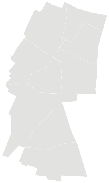
Potier in Pierrefitte-sur-SeinePotier highlighted; other neighbourhoods in grey
Source: IGN and Insee, IRIS boundaries and Admin Express 2024 (Open Licence 2.0)
People.
2,934 residents and 1,311 households at the 2022 census, next to the commune figure.
21%
aged under 15
HerePierrefitte-sur-Seine
23%
aged 15–29
HerePierrefitte-sur-Seine
17%
aged 60 and over
HerePierrefitte-sur-Seine
36%
of households are people living alone
HerePierrefitte-sur-Seine
31%
of households are couples with children
HerePierrefitte-sur-Seine
18%
of households are single-parent families
HerePierrefitte-sur-Seine
Source: Insee, 2022 population census (sub-municipal files, Open Licence 2.0)
Homes.
1,191 homes, 95% of them main residences, with 3.0 rooms on average.
18%
of homes are houses
HerePierrefitte-sur-Seine
17%
of households own their home
HerePierrefitte-sur-Seine
49%
of households rent social housing (HLM)
HerePierrefitte-sur-Seine
1%
second homes
HerePierrefitte-sur-Seine
4%
empty homes
HerePierrefitte-sur-Seine
53%
of households have a car
HerePierrefitte-sur-Seine
When main homes were built
before 19192%
1919–19454%
1946–197036%
1971–199026%
1991–200526%
2006–20196%
Source: Insee, 2022 population census (sub-municipal files, Open Licence 2.0)
Income and work.
Median living standard of €16,690 a year in 2021 (Pierrefitte-sur-Seine: €16,080).
€16,690median living standard a year2021
33.0%poverty ratethreshold: 60% of national median
€8,940the lowest-income 10% live on less than1st decile
€29,050the highest-income 10% live on more than9th decile
13.5%
unemployment among 15–64s (census definition)
HerePierrefitte-sur-Seine
20%
of over-15s who have left school hold a higher-education degree
HerePierrefitte-sur-Seine
4%
managers and professionals among over-15s
HerePierrefitte-sur-Seine
16%
retired among over-15s
HerePierrefitte-sur-Seine
Living standard is a household’s disposable income after taxes and benefits, divided by its consumption units. Half of residents live on less than the median. Income on its own says nothing about what a neighbourhood is like to live in.
Sources: Insee, Filosofi 2021 income data (Open Licence 2.0) · Insee, 2022 population census (sub-municipal files, Open Licence 2.0)
Everyday life.
What is within one kilometre of the centre of the neighbourhood. 48 public transport stops are within 800 m, and the nearest rail or tram station is 130 m away.
Figures for the whole commune of Pierrefitte-sur-Seine: major hazards listed by the State, prevention plans in force and natural-disaster declarations since 1982.
Floodingrun-off and mudflows, groundwater flooding
Ground movementcollapse of old quarries, clay shrinkage and swellingprevention plan
Severe weatherstorms
Transport of hazardous goods
8natural-disaster declarationssince 1989
July 2020latest recognised eventDrought (clay shrinkage)
Natural-disaster declarations by type
Floods and mudflows4
Drought (clay shrinkage)3
Ground movement1
A natural-disaster declaration (arrêté CatNat) lets insurers pay out for the damage. The count reflects past events, not a forecast of future risk. The list of hazards comes from each département’s major-risk file; a prevention plan in force limits building in exposed zones.
Source: Géorisques, GASPAR database (Open Licence 2.0), as of 5 October 2026
Nearest schools.
In a straight line from the centre of the neighbourhood.
Ecole primaire Frédérick LemaîtrePrimary school · state390 m
Ecole maternelle Jean JaurèsNursery school · state450 m
Ecole élémentaire Jean JaurèsPrimary school · state500 m
Ecole élémentaire Roselyne BoivinPrimary school · state560 m
Ecole élémentaire Anatole FrancePrimary school · state620 m
Ecole maternelle Anatole FranceNursery school · state620 m
Source: Ministry of Education, school directory (Open Licence 2.0). Admission depends on catchment rules.