Territoire de Belfort
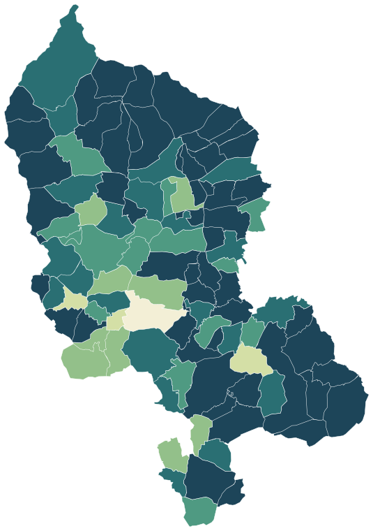
Territoire de Belfort has 140,082 residents in 101 communes. Over five years, homes sold for a median €1,490/m², from €1,230/m² in Giromagny to €1,940/m² in Offemont among communes of more than 2,000 people. 56% of households own their main home.
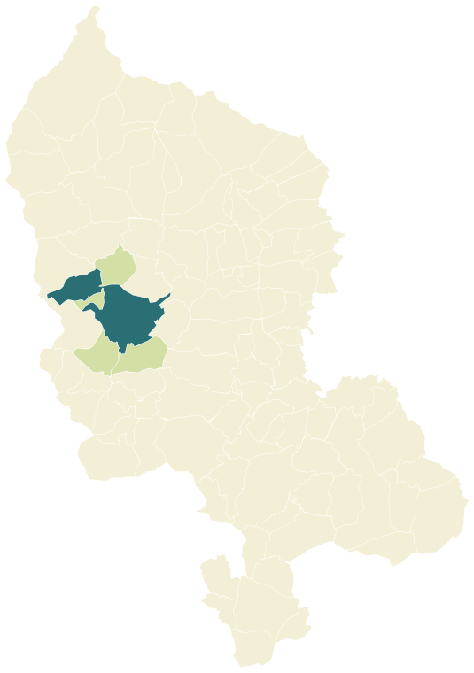
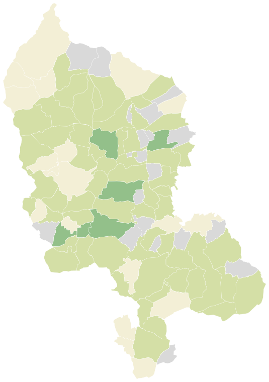
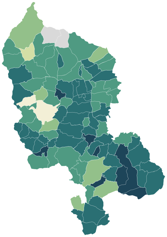
Four maps of Territoire de Belfort.
Each commune is coloured by its value; every map uses the same colour scale, from lowest to highest. Grey: not published.
Sources: IGN and Insee, IRIS boundaries and Admin Express 2024 (Open Licence 2.0) · DGFiP property sales (DVF), data.gouv.fr statistics (Open Licence 2.0) · Insee, Filosofi 2021 income data (Open Licence 2.0) · © OpenStreetMap contributors (ODbL)
The 12 communes with more than 2,000 people.
Colour shows where each commune sits among the others in the table, from lowest to highest.
| Commune | Residents | Price per m² | Living standard | Home owners | Aged 75+ | Unemployment | Green 500 m | Services 15 min |
|---|---|---|---|---|---|---|---|---|
| Bavilliers | 4,641 | €1,710/m² | €23,060 | 58% | 17% | 13.4% | 30% | 65 |
| Beaucourt | 4,985 | €1,380/m² | €22,360 | 57% | 13% | 11.8% | 11% | 43 |
| Belfort | 45,646 | €1,310/m² | €18,850 | 32% | 9% | 19.2% | 19% | 205 |
| Châtenois-les-Forges | 2,637 | €1,690/m² | €24,040 | 69% | 13% | 9.0% | 11% | 23 |
| Danjoutin | 3,531 | €1,530/m² | €22,260 | 50% | 10% | 14.9% | 14% | 72 |
| Delle | 5,677 | €1,430/m² | €21,660 | 48% | 10% | 19.5% | 47% | 41 |
| Essert | 3,382 | €1,840/m² | €25,050 | 68% | 13% | 11.4% | 26% | 34 |
| Giromagny | 2,897 | €1,230/m² | €20,890 | 52% | 17% | 13.4% | 25% | 46 |
| Grandvillars | 2,963 | €1,590/m² | €22,540 | 58% | 11% | 11.3% | 41% | 28 |
| Offemont | 4,054 | €1,940/m² | €23,320 | 65% | 8% | 13.3% | 22% | 22 |
| Valdoie | 5,193 | €1,350/m² | €21,030 | 54% | 12% | 16.3% | 14% | 82 |
| Évette-Salbert | 2,022 | €1,880/m² | €28,560 | 92% | 11% | 6.2% | 30% | 18 |
Sources: Insee, 2022 population census (sub-municipal files, Open Licence 2.0) · DGFiP property sales (DVF), data.gouv.fr statistics (Open Licence 2.0) · Insee, Filosofi 2021 income data (Open Licence 2.0) · © OpenStreetMap contributors (ODbL)
People.
140,082 residents and 64,933 households at the 2022 census, next to the département figure.
Source: Insee, 2022 population census (sub-municipal files, Open Licence 2.0)
Homes.
73,832 homes, 88% of them main residences, with 4.2 rooms on average.
When main homes were built
Source: Insee, 2022 population census (sub-municipal files, Open Licence 2.0)
Property prices.
8,229 house and flat sales over five years.
Median prices from sales published in France’s Demandes de valeurs foncières (DVF) over ten half-years, for sales of a single property. Individual sales are not shown. A median is only given where there were at least ten sales.
Source: DGFiP property sales (DVF), data.gouv.fr statistics (Open Licence 2.0)
Income and work.
Work and qualifications at the 2022 census.
Sources: Insee, 2022 population census (sub-municipal files, Open Licence 2.0)
Health, shops and services.
Facilities and services in Territoire de Belfort on 1 January 2025, from Insee’s permanent database of facilities.
Insee’s permanent database of facilities lists the shops, services and health professionals present in each commune on 1 January. Health professionals in private practice are counted one by one; several may work at the same address.
Source: Insee, permanent database of facilities 2025 (Open Licence 2.0)
Natural and industrial hazards.
Share of the département’s 101 communes exposed to each major hazard, and natural-disaster declarations since 1982.
Natural-disaster declarations by type
A natural-disaster declaration (arrêté CatNat) lets insurers pay out for the damage. The count reflects past events, not a forecast of future risk. The list of hazards comes from each département’s major-risk file; a prevention plan in force limits building in exposed zones.
Source: Géorisques, GASPAR database (Open Licence 2.0), as of 5 October 2026