NL · EN

Pendrecht

Pendrecht is a neighbourhood in the Charlois district of Rotterdam, with 12,745 residents and 5,627 homes. 31% of homes are owner-occupied and 29% are single-family houses. The average WOZ value (€249,000) is 27% below the municipal average. From a typical postcode here, 89 everyday services are within a 15-minute walk.

Neighbourhood 05991577 · 216 postcodes · Updated 24 October 2026
12,745residents1 January 2025
€249,000average WOZ home valueRotterdam: €342,000
26%green within 500 mRotterdam: 20%
89services within 15 minutesmedian postcode
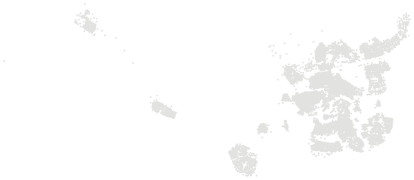
Pendrecht in RotterdamPostcodes in Pendrecht highlighted; the rest of Rotterdam in grey
Map of Rotterdam with Pendrecht highlighted

Who lives here.

12,745 residents in 5,875 households, 2.1 people per household on average; next to the figure for Rotterdam.

20%
aged 0–14
13%
aged 15–24
30%
aged 25–44
13%
aged 65 and over
46%
one-person households
38%
households with children

Source: Statistics Netherlands (CBS), Key figures for districts and neighbourhoods 2025 (CC BY 4.0)

Homes.

The average WOZ value of a home in Pendrecht is €249,000, against €342,000 in Rotterdam.

5,627homes82 newly built in 2025
29%single-family houses71% flats and apartments
31%owner-occupied55% housing association
4%built in the last ten years3% unoccupied
600 m³gas per home per yearRotterdam: 580 m³
2,180 kWhelectricity per home per yearRotterdam: 2,120 kWh
20%homes off the gas gridRotterdam: 24%
14%homes with solar panelsRotterdam: 11%

The WOZ value is the official valuation each Dutch municipality sets every year for property tax. It is not a sale price. The averages here use the valuation date of 1 January 2024.

Source: Statistics Netherlands (CBS), Key figures for districts and neighbourhoods 2025 (CC BY 4.0)

Income and work.

How households in Pendrecht compare with the national income distribution (reporting year 2024).

54%of households in the lowest 40% nationallyRotterdam: 51%
10%in the top 20% nationallyRotterdam: 14%
7.9%of residents live below the poverty lineRotterdam: 6.3%
€5,000median household wealthRotterdam: €13,000
62.0%of 15 to 75-year-olds in workRotterdam: 67.0%
14%with a university or higher professional degreeRotterdam: 33%
17.0%of workers are self-employedRotterdam: 17.0%
0.7cars per householdRotterdam: 0.6

Statistics Netherlands ranks every household in the country by income. In a neighbourhood that matched the national mix exactly, 40% of households would fall in the lowest 40% nationally and 20% in the top 20%. Income on its own says nothing about what a place is like to live in.

Source: Statistics Netherlands (CBS), Key figures for districts and neighbourhoods 2024: income, work and education (CC BY 4.0)

Safety.

Police registered 650 crimes in Pendrecht in 2025, 18% fewer than in 2024. That is 51.0 per 1,000 residents, compared with 78.5 across Rotterdam.

Other property crime104
Vandalism and criminal damage69
Theft of bicycles and mopeds50
Theft from vehicles37
Assault34
Threats31
Driving under the influence18
Burglary of homes10
Vehicle theft6
Public violence against people5
Pickpocketing3
Street robbery2
Hold-up robbery1

Registered crime shows what becomes known to the police, not how safe a place feels, and not every crime is reported. Town centres, shopping areas and the streets around stations have few residents but many visitors, which pushes the rate per 1,000 residents up. The categories above are a selection; the total includes every registered crime.

Source: Dutch Police, registered crime by district and neighbourhood, 2024–2025 (CC BY 4.0)

Everyday distances.

Average distance by road for everyone living in Pendrecht, a very highly urban area.

Distance to

GP practice0.5 km
Large supermarket0.5 km
Day nursery0.3 km
Primary school0.4 km

Also

Primary schools within 3 km15.1
Primary pupils living here1,390
Secondary pupils living here820
Business premises1,500
Residents per km²10,470
Land area122 ha

Source: Statistics Netherlands (CBS), Key figures for districts and neighbourhoods 2025 (CC BY 4.0)

Schools in Pendrecht.

Primary and secondary school sites with an address in this neighbourhood.

Basisschool Over De SlingePrimary school · Openbaar
BeatrixschoolPrimary school · Protestants-Christelijk
Oecomenische Basisschool de HoeksteenPrimary school · Protestants-Christelijk

Source: DUO Open Education Data: primary and secondary school locations (CC BY 4.0). Admission depends on each school's own policy.

Every postcode in Pendrecht.

216 postcodes, each with its own report. The figure is the share of green space within 500 m.

3086 AA52%3086 AD51%3086 AE51%3086 AJ50%3086 AK48%3086 AM48%3086 AN47%3086 AP45%3086 AR43%3086 AS47%3086 AV42%3086 AW38%3086 BC40%3086 BD40%3086 BE33%3086 BG35%3086 BH35%3086 BJ33%3086 BK40%3086 BL45%3086 BM39%3086 BN28%3086 BP19%3086 CA16%3086 CB16%3086 CC16%3086 CD16%3086 CE47%3086 CG32%3086 CH28%3086 CJ21%3086 CK47%3086 CL33%3086 CM28%3086 CN22%3086 EA12%3086 EB11%3086 EC13%3086 EG15%3086 EH16%3086 EJ16%3086 EK15%3086 EL15%3086 EM12%3086 EN16%3086 EP16%3086 ER16%3086 ES17%3086 ET17%3086 EV17%3086 EX15%3086 EZ17%3086 GA27%3086 GB35%3086 GC31%3086 GD14%3086 GE25%3086 GG20%3086 GH19%3086 GJ27%3086 GL27%3086 GN16%3086 GP16%3086 GS21%3086 GT26%3086 GV30%3086 GW35%3086 GZ18%3086 HA36%3086 HB28%3086 HC25%3086 HD36%3086 HE29%3086 HG33%3086 HH41%3086 HJ37%3086 HK30%3086 HL20%3086 HM18%3086 HN16%3086 HR29%3086 HT21%3086 HV29%3086 HW27%3086 HX25%3086 JA29%3086 JC19%3086 JD18%3086 JE20%3086 JG20%3086 JH25%3086 JK22%3086 JL16%3086 JM27%3086 JN23%3086 JP25%3086 JR34%3086 JS22%3086 JT22%3086 JV26%3086 JW31%3086 KA24%3086 KC28%3086 KD30%3086 KE25%3086 KH28%3086 KJ28%3086 KK22%3086 KM27%3086 KN29%3086 KS26%3086 KT28%3086 KV28%3086 KW28%3086 LC26%3086 LD29%3086 LE21%3086 LH27%3086 LJ30%3086 LK11%3086 LL13%3086 LN16%3086 LP14%3086 LS23%3086 LT26%3086 LV26%3086 LW16%3086 LX22%3086 LZ26%3086 NA22%3086 NB24%3086 NC20%3086 ND24%3086 NE24%3086 NG25%3086 NH26%3086 NK17%3086 NM33%3086 NP21%3086 NR20%3086 NS33%3086 NT37%3086 NV33%3086 NW36%3086 PA23%3086 PB25%3086 PC19%3086 PG28%3086 PH20%3086 PM33%3086 PN21%3086 RA19%3086 RD29%3086 RE31%3086 RG17%3086 RH18%3086 RJ26%3086 RM28%3086 RN31%3086 SB33%3086 SC31%3086 SE34%3086 SG31%3086 SH35%3086 SK31%3086 SN27%3086 SR30%3086 ST31%3086 TA16%3086 TB16%3086 TC18%3086 TD17%3086 TE16%3086 TG16%3086 TH16%3086 TJ15%3086 TK15%3086 TL14%3086 TM15%3086 TN18%3086 TP19%3086 VC26%3086 VR24%3086 VS28%3086 VT24%3086 VV29%3086 WB32%3086 WC26%3086 WE31%3086 WG35%3086 WJ32%3086 WK36%3086 WL20%3086 WN22%3086 XA23%3086 XC17%3086 XD29%3086 XE32%3086 XH37%3086 XJ29%3086 XL17%3086 XM24%3086 XN28%3086 XP33%3086 XR37%3086 ZA16%3086 ZB15%3086 ZC47%3086 ZD41%3086 ZE31%3086 ZG25%3086 ZH20%3086 ZJ47%3086 ZK41%3086 ZM30%3086 ZN21%

Nearby neighbourhoods.

The closest neighbourhoods in Rotterdam.