Wales
Wales has 3,107,491 residents in 22 local authorities (Census 2021). Homes sold for a median of £218,000 over the past two years, from £140,000 in Blaenau Gwent to £320,000 in Monmouthshire.
3,107,491residentsCensus 2021
£218kmedian sale price74,013 sales, 24 months
24%green within 500 mpostcode average
81%gigabit broadbandpremises, Ofcom 2025
Wales by postcode sector
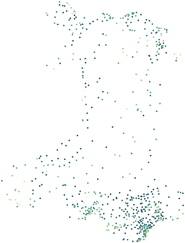
0%30%+
Average share of land within 500 m that is green space, by postcode sector
Map data © OpenStreetMap contributors · ONS Postcode Directory · HM Land Registry · WIMD 2025 · Ofcom Connected Nations
Local authorities in Wales.
Every local authority has its own maps, a page for each ward and a report for every postcode. The greenest is Ceredigion, with 60% of land near homes in green space.
| Local authority | Residents | Median price | Green 500 m | Services 15 min | Gigabit | Crime per 1,000 | Postcodes |
|---|---|---|---|---|---|---|---|
| Cardiff | 362,308 | £270k | 19% | 114 | 94% | 118 | 7,680 |
| Swansea | 238,490 | £201k | 17% | 48 | 90% | 91 | 5,797 |
| Rhondda Cynon Taf | 237,651 | £165k | 27% | 30 | 79% | 87 | 5,430 |
| Carmarthenshire | 187,897 | £197k | 27% | 10 | 69% | 88 | 6,733 |
| Caerphilly | 175,952 | £195k | 34% | 32 | 89% | 107 | 4,359 |
| Newport | 159,592 | £235k | 23% | 79 | 94% | 145 | 3,668 |
| Flintshire | 154,962 | £216k | 24% | 30 | 91% | 77 | 4,546 |
| Bridgend | 145,488 | £218k | 18% | 38 | 90% | 86 | 3,279 |
| Neath Port Talbot | 142,289 | £165k | 25% | 28 | 83% | 83 | 3,665 |
| Wrexham | 135,117 | £200k | 23% | 30 | 79% | 103 | 4,354 |
| Powys | 133,169 | £250k | 21% | 7 | 59% | 78 | 6,124 |
| Vale of Glamorgan | 131,939 | £285k | 26% | 70 | 91% | 75 | 3,116 |
| Pembrokeshire | 123,360 | £225k | 16% | 11 | 66% | 92 | 5,019 |
| Gwynedd | 117,393 | £195k | 27% | 13 | 64% | 91 | 5,601 |
| Conwy | 114,741 | £218k | 20% | 38 | 86% | 106 | 4,120 |
| Denbighshire | 95,817 | £200k | 19% | 55 | 80% | 114 | 3,423 |
| Monmouthshire | 92,957 | £320k | 28% | 17 | 78% | 82 | 3,305 |
| Torfaen | 92,276 | £200k | 18% | 38 | 86% | 127 | 2,574 |
| Ceredigion | 71,475 | £235k | 60% | 4 | 51% | 92 | 3,076 |
| Isle of Anglesey | 68,878 | £225k | 22% | 11 | 57% | 74 | 2,896 |
| Blaenau Gwent | 66,904 | £140k | 33% | 31 | 71% | 151 | 1,849 |
| Merthyr Tydfil | 58,836 | £145k | 32% | 41 | 78% | 110 | 1,632 |
Sources: Census 2021 (ONS) · HM Land Registry Price Paid Data, sales to 28 Aug 2026 · © OpenStreetMap contributors · Ofcom Connected Nations 2025 · data.police.uk